Guest Post by Anqi Chen
Located in a small corner of the Research Commons on the third floor of the 18th Avenue Library, a small display highlights two colorful examples from the Japanese collections held by The Ohio State University Libraries: geological maps of Mount Fuji, the highest peak in Japan and one of the country’s most recognizable natural and cultural landmarks.
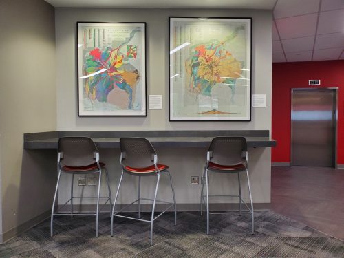
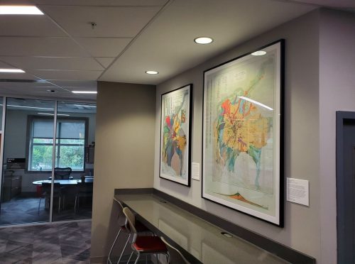
Mount Fuji is an active volcano located near the geographic center of Japan, and its geological structure has been the subject of sustained interdisciplinary attention. The two maps featured here were produced by the Geological Survey of Japan (地質調査総合センター): one published in 1968 by Hiromichi Tsuya, and a second, updated version published in 2016 by Akira Takada, Takahiro Yamamoto, Yoshihiro Ishizuka, and Shun Nakano. Displayed together, they reflect more than a half century of geological research and illustrate how scientific approaches to studying Mount Fuji have developed over time.
Through their careful color-coding and layered visual detail, these maps also convey Mount Fuji’s complexity as a volcanic system. Displayed in the context of Japan’s most recognizable and culturally significant mountain, they also prompt reflection on the long-standing importance of Mount Fuji in Japanese history, belief, and visual culture. Seen together, they encourage viewers to consider scientific knowledge alongside broader humanistic understandings of place.
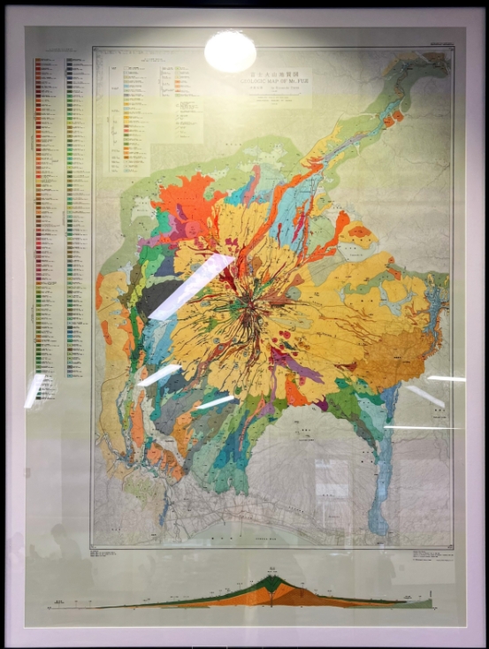
Geologic Map of Mt. Fuji, 1968, Hiromichi Tsuya
This small display also gestures toward the broader scope of Japanese cartographic materials at OSU. The Ohio State University Libraries hold more than 2,800 cataloged Japanese-language maps, with many additional items remaining uncatalogued. These materials constitute the Libraries’ largest non-English-language map holdings and rank among the most extensive collections of Japanese-language cartography in North America (Davis, et al. 2023). Notable holdings include early modern maps of Edo (present-day Tokyo), such as the Zōho kaisei Edo kiriezu (増補改正江戸切絵図), preserved in the Rare Books & Manuscripts Library.
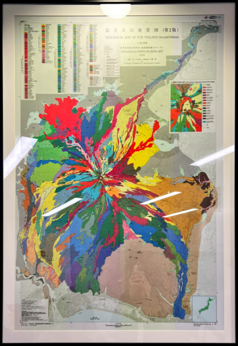
Geologic Map of Fuji Volcano (Second Edition), 2016, Akira Takada, Takahiro Yamamoto, Yoshihiro Ishizuka, and Shun Nakano
Although modest in scale, this corner display reflects both the depth of OSU’s Japanese map collections and ongoing efforts to make these materials more visible and accessible for research and teaching across disciplines. It was made possible by work that began in the summer of 2022, when librarians initiated a student-focused project to survey, describe, and better understand OSU’s Japanese-language maps. That early work was introduced in several earlier blog posts, starting with “Exploring Japanese Maps—A Summer Project,” and later discussed in greater depth in the co-authored article, “Lost in Translation: Engaging Student Employees to Surface Japanese Language Maps for a Broader Audience,” published in 2023.
Acknowledgments
A special thanks to Professor Mineharu Nakayama (Professor of Japanese linguistics), for his thoughtful and critical edits to the final draft of the exhibit’s bilingual labels. The Japanese Maps Project was launched in partnership with Professor Daniel Dotson (Head of the Orton Memorial Library of Geology & Gardner Family Map Room) and Professor Joshua Sadvari (Geospatial Information Librarian). The exhibit itself was coordinated by Jarod Ogier (Public Services Coordinator, Research Commons), Jeremy Stone, (Exhibits Coordinator), and Cameron Sharp, (Head Exhibitions Preparator). Additional thanks to Jan Wagner (Maps Information Associate) and Ed Plunkett (English/Maps Cataloging Specialist) for their expertise and support at key stages of the project.