

Interior of aerogram depicting Japanese battles in the Pacific
On February 14th, I wrote a blog introducing the Pearl Harbor Exhibit that was hung last winter in commemoration of the 75th anniversary of Pearl Harbor (December 7, 2016). In order to showcase the Japanese military perspective, the exhibit included a very special document, a fold-up aerogram that was made by the Japanese wartime government. The present blog will feature that document, known as gunji yūbin (軍事郵便), or “military mail” in English.
Gunji Yūbin (軍事郵便)
Gunji yūbin was the military mail service that connected soldiers on the front lines to their families back in the metropole. It was established in 1894 (Meiji 27) during the Sino-Japanese War. Because the gunji yūbin was responsible for handling all letters going back and forth between the soldiers and their families, its extant pieces can be a treasure trove for researchers of war-time and Imperial Japan.
Kōa Shingun Ezu Nyūfūkan (興亜進軍絵図入封緘)
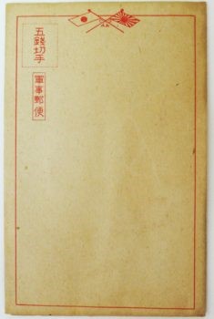
Aerogram exterior shown folded as an envelope
One such remnant is a fold-up envelope, or aerogram, which upon unfolding, provides the postal recipient with a map showing the expansion of Japanese military actions in the early 1940s. Entitled 興亜進軍絵図入封緘葉書 (or “Map of Military Marching for the Development of Asia”), the interior also includes a detailed chronology of Japanese military victories from 1941 to 1943. Issued by Niigata Tsuda Company in 1943, the main purpose of the aerogram was to illustrate ongoing battles, focusing on Japanese naval and land successes across the globe.
The map also highlights Japan’s relations with other nations in the early 1940s. Countries and regions shaded in red represented the territory of the Japanese Empire or Axis powers. Areas colored in white were known as enemies. These included countries such as the United States, Great Britain, Republic of China, and other Allied powers. Countries shaded in yellow, such as the U.S.S.R., had peace treaties or neutral relationships with Japan at the time of publication.
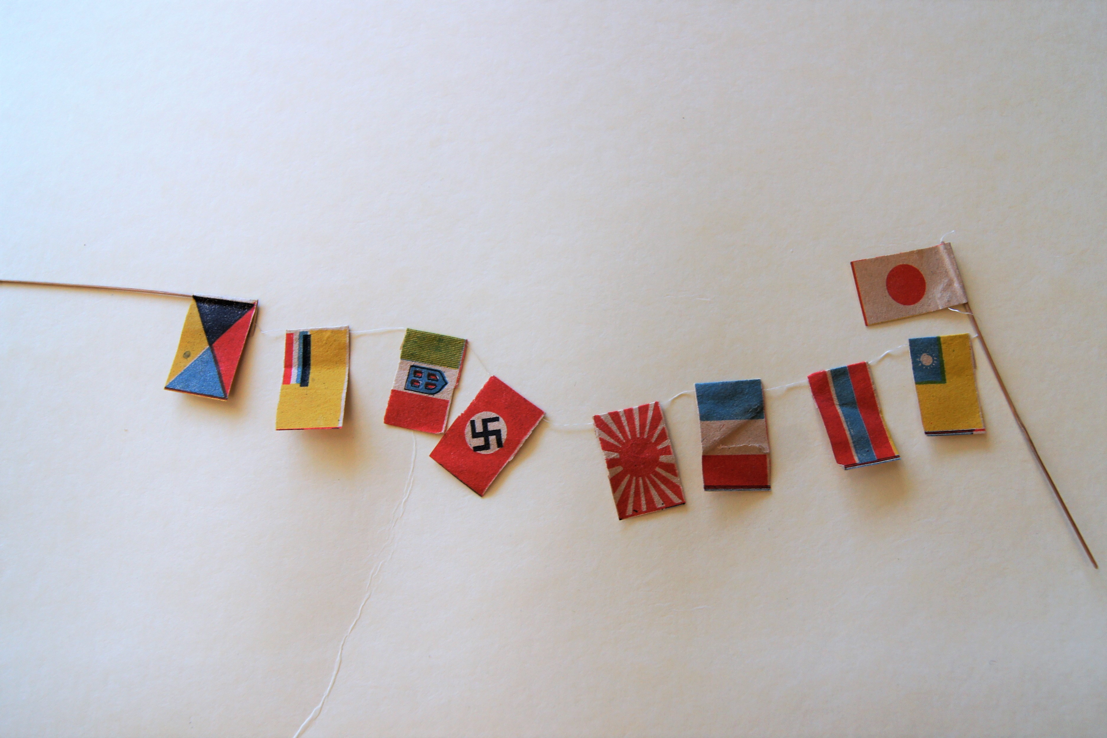
Flags of Friends and Allies
Another noteworthy point is a series of flags, which were attached and intended for the recipient to assemble as a type of three-dimensional decoration linking key territories in the Pacific Rim. Among these were the flags of Japan, Republic of China, Thailand, France, Germany, Italy, and Manchuria, as well as the Japanese military flag and Z flag, symbolizing Japanese victories. The small paper flags were linked together on a single string, suggesting the bonds of friendship and victory between these entities. Bamboo rods at the end of the string of flags were designed for insertion into special folds on the map.
Scholars and students wishing to access this rare material may refer to the item record in the OSU Libraries catalog: http://library.ohio-state.edu/record=b8088091
For more information on Japanese activities during WWII available at OSUL:
Never Look Back: A History of WWII in the Pacific by William A Renzi; Mark D Roehrs (Armonk, 1991)
Japan’s War : the Great Pacific Conflict, 1853 to 1952 by Edwin P Hoyt (Da Capo Press, 1991)
Competing Voices from the Pacific War : Fighting Words by Chris Dixon, Sean Brawley, Beatrice Trefalt (Greenwood Press 2009)
For more pictures and information on the map, we recommend the blog entry here (Japanese language).

Detailed view of major military battles including the bombing of Pearl Harbor and campaign at Guadacanal